Thugga or Dugga is a UNESCO World Heritage Site (http://en.wikipedia.org/wiki/Dougga) located south-west of Tunis on a high plateau, 500 meters above sea level, in the center of a fertile area. There are different spellings for the location due to different letters between the Arabic and Berber languages, but it's name is derived from the Berber (Libyan) word 'to protect'.
We started out at 11 am, it was a cold and sunny day. On the way there, we drove through some small towns along a small lake called Subkhet Sijoumi where we saw Flamingos!
The modern towns on the way are typical in that the commercial areas are along the road and there are people walking all over, busy with their lives. Note that the street signs are in Arabic & French so with a GPS it's easy to find your way throughout the country for the most part!
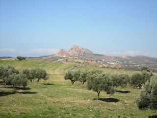
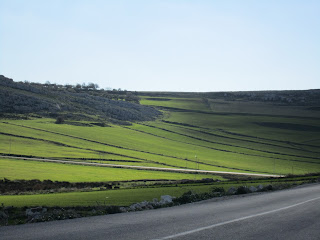
Outside of the towns, the scenery is amazingly beautiful! There are verdant hills, olive groves, vineyards, wheat fields, rocky mountains and towns tucked here and there. Shepard with their sheep and dogs are often seen near the roads.
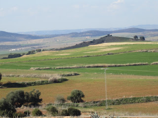.JPG) |
| Now I know why they call it "Green Tunisia"! |
.JPG) |
| The ubiquitous Olive tree! |
.JPG) |
| Crag in the distance |
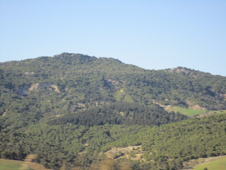.JPG) |
| There seem to be several reforestation projects throughout the country |
.JPG) |
Green wheat fields
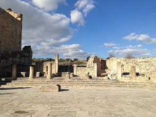
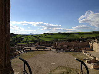
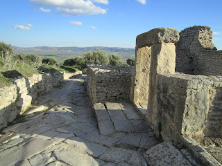
Dugga Ruins |
The Romans were all over the North Africa coast that faces the Mediterranean, but Dugga's history goes back much further to the Numidian-Berber civilization, to 6th BCE. What makes Dugga a really important site is the fact that it was originally a city built by the native inhabitants, the Numidian-Berbers that stretched from Libya. They were later living together with the Carthaginians The Carthaginians are Phoenicians who migrated west to Carthage after Alexander the Great conquered the Levant and are also referred to as Punic (http://ancienthistory.about.com/od/phoenicians/f/011611-What-Does-Punic-Mean.htm).
When the Romans came and conquered Dugga, they allowed the indigenous people to coexist in the same city for two centuries and there were separate administrations for the different populations. Eventually they became integrated as Roman citizens and part of the Roman Empire in Africa.
Upon entering the parking at the site, an elderly man offered to be our tour guide. He spoke English and we engaged him for 2 hours for 40 Tunisian Dinars. Much of what he told us checked out with the Wikipedia references, so if there's something I say that's wrong, it's because I am merely repeating what he told us! I am not sure about the 'Byzantine' walls, but someone built over the Roman ruins and there is a church somewhere so it may be true!! There was a small cafe and bookstore, but no tour books in English, only French!
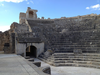
The Theatre
At the entrance of the site is the Theatre, built in 168 or 169 BCE. It could seat 3500 spectators and still has good acoustics!
.JPG) |
| Standing Backstage |
.JPG) |
| Back Stage Area where spectators entered the arena |
.JPG) |
| Front Stage with indentations forming orchestra pits, actors' entrance to left of the stage through arch |
There are three entrances for actors: the center and one on each side through an arched door
.JPG) |
| View from Stage looking at seating & Actor's side entrance through arch door, orchestra pits at edge of stage on left |
.JPG) |
| Lots of spectator room! |
 |
| Backstage passage for actors leading to Stage's left side entrance |
 |
| Actor's backstage entrance to Center front stage |
.JPG) |
| Next to each Actors' side entrance is a narrow window for the prompter to remind actors of their lines! |
The Temple of Mercury & The Square of the Rose of the Winds
The Square of the Rose of the Winds is an open area with a large circle carved into the stone with the names of various winds and their characteristics. It is in front of a ruin of the Temple of Mercury
.JPG) |
| Temple of Mercury behind the Square of the Rose of the Winds (an open area plaza) |
The Square of the Rose of the Winds' floor is engraved with names of 12 winds in a circle showing the direction they blow: kind of like a 'wind dial'
.JPG) |
| African Winds |
.JPG)
.JPG) |
| Center of the Circular Wind Map |
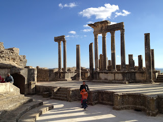
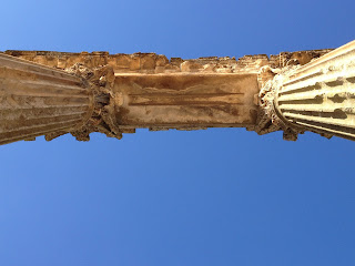
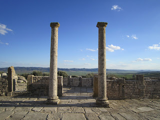
The Capitol
The Capitol is a Roman temple from the 2nd century CE. It was dedicated to 3 gods: Jupiter, Juno and Minerva. Each pillar is made from one piece of marble, 30 meters in height! It is between the Temple of Mercury and the Square of the Rose of the Winds on one side and the Forum on the other side.
.JPG) |
| Impressive! |
The Capitol is at the apex of the hill and can be seen from any other location
.JPG) |
Under the Capitol
.JPG) |
Each column is made from one piece of marble!
|
|
.JPG) |
| Inside the Capitol are 3 vestibules for the different Gods: Juno, Minerva and Jupiter |
.JPG) |
| Minerva?? |
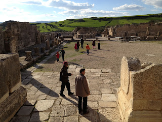
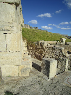
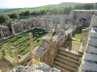
The Forum
The Forum is a meeting place where public speeches and gatherings occurred.
.JPG) |
| A view of the Forum from the Capitol |
 |
| An ancient stone that was made into a grinding wheel and then reclaimed! |
 |
| Entrance to the Forum |
.JPG) |
| View of the Forum with Alexander Severus's Arch in the background |
 |
| Curved Columns are an example of Punic, not Roman, architecture |
.JPG) |
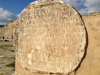
| Walls of the Forum with inscriptions in Latin |
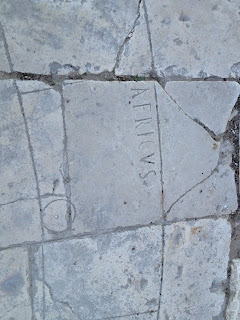
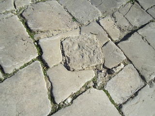
There are a variety of proclamation stones to commemorate the various Emperors' changes in status of the location over time. There are random stones with Roman engravings all throughout the ruins, but no signs telling you what they say!
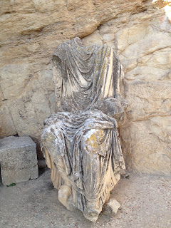.JPG) |
| Headless Emperor |
.JPG) |
| Roman Gods and Goddesses |
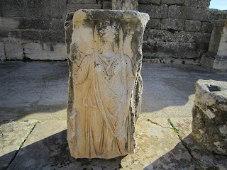.JPG) |
| Minerva? |
.JPG) |
Alexander Severus's Arch
Built in 222-235, the arcade is 4 meters high & the road to
Algeria goes through it |
One civilization over another!
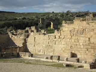
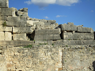
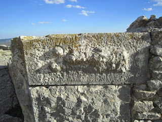
When the Byzantines came they built over the Roman ruins. This can be seen in the walls where Roman stones were built over by Byzantine stones:
.JPG) |
| Roman on the bottom, Byzantine over it |
.JPG) |
| Byzantine blocks aren't flat like Roman blocks, but have a protruding center area that gives the walls a bumpy look |
.JPG) |
| Byzantine Wall with bumpy surface |
.JPG) |
| Hitching holes for horses along the road |
There are also some areas where a Byzantine wall was built right over a Roman house's mosaic floor!
.JPG) |
| Wall over a Roman mosaic! |
.JPG) |
| There goes the living room! |
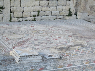
Ancient Villas
There is an area of the ruins where there are many villas clumped together along winding roads down the side of the hill. Some villas still have walls standing so you can go into the rooms, some only have blueprint outlines of where rooms used to be. In any case, they all belonged to wealthy families and you can see the mosaic floors, floor drains & even a toilet!
.JPG) |
| Winding roads due to location on a hill |
.JPG) |
| Ruins of village below the monuments |
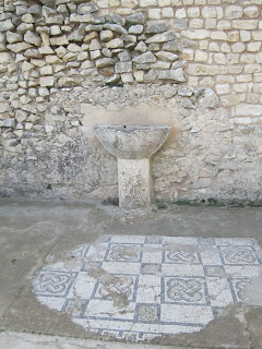
Inside some Villas
.JPG) |
| Floor mosaics and stone door post holder |
.JPG) |
| House with indoor garden area covered in mosaics |
.JPG) |
| Indoor fountain with mosaic floor |
.JPG) |
| Private Toilet |
Trifolium Villa
Our guide told us that this was a brothel!! He claimed that this stone was carved with directions on how to get there!
 |
| Note the two breasts to the left of an 'arrow' pointing the way |
In the Wikipedia this structure is identified as the Trifolium Villa. The guide told us that the covered passage was a way for men to visit the brothel unobserved. It would be helpful if the Tunisian government had small plaques that described what each place was and a little history because you really don't know what to believe! Of course, Roman cities did have brothels and there is one at Roman City of Ephasis in Turkey.
.JPG) |
| Covered passage leading down the hill to bottom of Trifolium Villa |
.JPG) |
| Entrance columns to Trifolium Villa on Street |
.JPG) |
| Going inside, nook for a statue of a God/dess |
.JPG) |
| Main courtyard & gardens with surrounding rooms are downstairs due to the hill |
Another house:
Arched house entrance from the street
.JPG) |
| Inside Livingroom |
.JPG) |
| Inside rooms of the house, note the window |
.JPG) |
| The window is on the street level due to the incline of the hill |
House of Venus
.JPG) |
| Entrance Door to House of Venus |
.JPG) |
| Note 3D mosaics! |
.JPG) |
| Tree of Life Mosaic |
.JPG) |
Byzantine's building over House of Venus!
Out with the old & in with the new! |
 |
| Drainage hole in floor |
 |
| Close Up! |
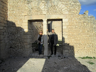
Dar Lacheb
This is the portal to a house built between 164 and 165 CE and shows a well preserved entrance. Our guide told us that it was the Gymnasium!
.JPG) |
| Dar Lacheb Arch with Capitol in background |
.JPG) |
| Inside garden space with rooms around perimeter |
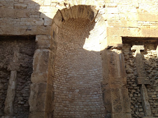
Antonian or Licinian Baths
The Licinian Baths are several storeys high and are built around 3 BCE. They had hot and cold water baths. This impressive complex still has it's walls intact and can be seen from the ruins as a large structure on the hill
At the base of the hill, you can still see the drainage pipes and the arched tunnels, lined with hot water pipes where slaves used to light fires to heat up the water
.JPG) |
| Drainage pipes |
.JPG) |
| Arches lined with hot water pipes |
.JPG) |
| Network of underground hot water archways with traces of carbon from fires used to heat walls |
 |
| Central courtyard with Hot baths on left and Cold baths on right |
 |
| View with Capitol behind, up on the hill |
.JPG) |
| Entrance to resting area for after the bath |
.JPG) |
| Resting area for after the baths |
 |
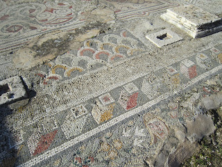
| Mosaic floors |
.JPG) |
| Hot water bathing areas |
 |
| Baths open to each other through open windows, nook for God/dess statue |
 |
| Side Temple off Baths |
 |
Remnants of Marble covered walls lining the entire complex (at base of walls)

The Bath of the Cyclopses |
Named after a mosaic found which depicts Cyclopses helping forge thunderbolts for Jupiter (in the Bardo museum), this is some type of public toilet, which our tour guide said was for both men and women!
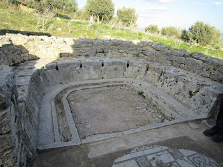 |
| 12 Communal Toilets |
 |
| Sink for washing hands, mosaic floors |
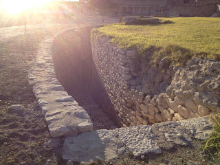
Roman Plumbing
Large cities couldn't survive without plumbing and sanitation and the Romans left some impressive testaments to their engineering genius. In addition to pumping water from underground wells to furnish fountains and baths and toilets, the roads had equally spaced manhole covers that gave access to underground sewers:
.JPG) |
| Underground sewer |
.JPG) |
| Roman Road with chariot wheel grooves |
.JPG) |
| Manholes in road above sewers |
.JPG) |
Manhole closeup
|
 |
| Floor Drain |
Punic-Libyan Mausoleum
Because we arrived late in the day, and the sun sets at 5:30pm, there were some things that we only got to see from a distance because we were running out of daylight. We will definitely return to see many of the other ruins, including the Punic-Libyan Mausoleum which is a rare example of royal Numidian architecture.
This tomb is 21 meters tall and built in the 2nd century BCE. According to Wikipedia, in 1842, British consul in Tunis, Sir Thomas Read, damaged the monument to remove what he thought was it's inscription stone declaring that the tomb was dedicated to Atban, son of Iepmatath and Palu. Apparently it was inscribed with the names of the architects instead! The inscription was bilingual and along with another similar bilingual stone, aided in the translation of the ancient Numbidian language (kind of like the Rosetta Stone!)
On the Way Home!
.JPG) |
With the sun setting, everyone was heading home, including the shepherds and sheep!
We will definitely return to see and explore more of this amazing site in the future! |

.JPG)
.JPG)
.JPG)
.JPG)
.JPG)
.JPG)
.JPG)
.JPG)
.JPG)
.JPG)
.JPG)
.JPG)
.JPG)
.JPG)
.JPG)
.JPG)
.JPG)
.JPG)
.JPG)
.JPG)
.JPG)
.JPG)


.JPG)
.JPG)
.JPG)
.JPG)
.JPG)
.JPG)
.JPG)
.JPG)
.JPG)
.JPG)
.JPG)
.JPG)
.JPG)
.JPG)
.JPG)
.JPG)


.JPG)


.JPG)
.JPG)
.JPG)
.JPG)
.JPG)
.JPG)
.JPG)
.JPG)
.JPG)
.JPG)
.JPG)
.JPG)
.JPG)
.JPG)
.JPG)
.JPG)
.JPG)
.JPG)
.JPG)
.JPG)
.JPG)

.JPG)
.JPG)
.JPG)
.JPG)

.JPG)
.JPG)
.JPG)
.JPG)
.JPG)
.JPG)
.JPG)


.JPG)
.JPG)
.JPG)
.JPG)

.JPG)
.JPG)


.JPG)
.JPG)


.JPG)

.JPG)


.JPG)
.JPG)
.JPG)
.JPG)

.JPG)
.JPG)
.JPG)